Spatial Data Infrastructure of the Azores (IDE.A)

About this good practice
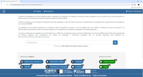
This SDI was implemented by the Regional Secretariat for the Environment and Climate Action of the Government of the Azores, and is freely accessible to all Regional Government entities, allowing them to host geographic information in dedicated databases, publish map services, create and publish geographic viewers, create metadata datasets, services and series through Azores Metadata Manager (GeMA) and share them through the Azores Metadata System (SMA).
As a result, in the metadata catalog (SMA) currently is possible to find 425 dataset metadada, of which 31 relate to geographic information whose production was based on satellite images, and 391 services metadata.
In the Geographic Viewers Platform, it’s available 61 viewers, which 36 have free access and the remaining 25 are restricted, as they are related to internal work of regional entities.
The published geographic viewers concern to different thematic areas, e.g.: territorial planning, nature conservation, water resources, natural risks, coastal management and climate change.
Therefore, IDE.A allows the access to geographic information in a faster and more efficient way, also working as a key element in supporting public decision-making by the regional entities.
Resources needed
Total cost of IDE.A: €229.810,86 (€161.440,45 was 85% financed by PO Açores 2020)
Human resources: 3-4 technicians dedicated to IDE.A, which is currently operated by the Environmental Planning and Promotion Office of the Regional Secretariat for the Environment and Climate Action.
Evidence of success
IDE.A was officially launched by the Government of the Azores in October 2023, and its success is evidenced by the current number of geographic viewers (61 viewers), by the 425 metadata datasets available in the regional metadata catalog (SMA), which communicates with the national catalogue, and also by the involvement of regional and local entities (47 entities), in sharing their geographic information about the Azores, through IDE.A.
Potential for learning or transfer
It is extremely important to integrate satellite data into an SDI, due to the added value they bring to the visualization and production of information, being an added value for spatial planning.
IDE.A aims to be another support tool for political decision-makers and the more and better the information available, the better and more accurate decisions will be made.
In order to take greater advantage of this entire SDI and the added value that satellite data provides, it is extremely important to have qualified technicians, constantly training and developing their knowledge.


