SATSDIFACTION's 4th Learning Deep Dive in Montpellier

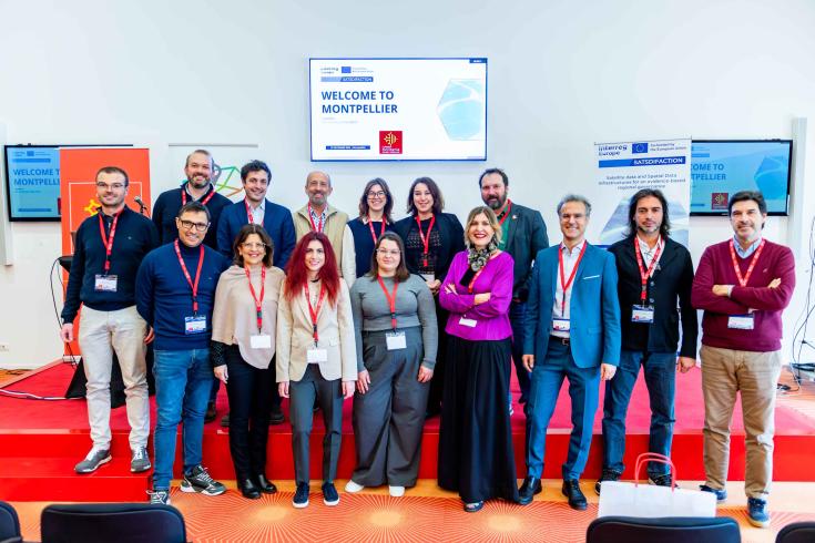
The 4th SATSDIFACTION Learning Deep Dive (LDD) was hosted by the region of Occitanie, from 10-12 December 2024, in Montpellier. This event brought together experts, policymakers, and stakeholders to exchange knowledge on using spatial data infrastructures to tackle climate change and improve territorial policies.
On the first day, hosted at Espace Capdeville, the event commenced with the opening remarks by Marie-Thérèse Mercier, Regional Councillor, who emphasized Occitanie’s leadership in spatial technologies.
Mirko Mazzarolo from the Veneto region, the project’s coordinator, and Margarita Chrysaki, NEREUS Communication, Policy, and Project Officer, shared an overview of the initiative, its importance in strengthening regional ecosystems, and its impact at the European level.
Morning sessions focused on regional strategies for integrating spatial data into climate policies, aligning with the Green Deal, and addressing environmental challenges. Key speakers included: Marie-Laure Pouilles, Head of Research Department, Direction of Innovation, Industry, Research and Higher Education, Occitanie Region, Karine Jacquelin, Data and Territory Department Manager, Information and Digital Department, Occitanie Region,Maud Murgue, Mission Leader: Green Deal and Climate Change, Occitanie Region, Luc Bidard, Head of Green Deal and Climate Change Mission.
Afternoon discussions turned to the dynamics of the space industry in Occitanie and collaborative approaches to foster climate resilience and innovation. Speakers included: Sylvie Teysseyre, Head of Data Economy in Space for Aerospace Valley, Aerospace Valley, Bastien Nguyen Duy-Bardakji, Co-founder and Managing Director, La TeleScop, Pierre Maurel, Director, UMR TETIS - INRAE and Member of the O3T Steering Committee (Earth Observation and Territories in Transition), François Jocteur Monrozier, Deputy Director for Missions, Earth Observation Data and Downstream Applications, CNES, Frédéric Huynh, Director, Data Terra Research Infrastructure, Arnaud Ceyte, Head of Satellite Unit, CEREMA, Anne Fromage-Mariette, Director, OPenIG, Alexandre Richard, Coastal Studies Officer, Occitanie Region, Alexian Ajas, EID Méditerranée, Johanna Bonnefoy, GIS Project Manager and PEP-BiOccIA Project Coordinator
The second day delved into practical applications, beginning with a morning field visit to "Le Petit Travers" to observe coastal erosion and learn about mitigation strategies. Workshops included using satellite imagery to monitor shoreline retreat in Villeneuve-lès-Maguelone and hands-on sessions with the QField app for real-time field data management. The day concluded with a networking session followed by a social dinner, providing participants the opportunity to enjoy local French delicacies while exchanging ideas and building new connections.
The final day, hosted at the Maison de la Télédétection, centered on the use of satellite data in agriculture and water resource management. Presentations by Isabelle Biagiotti, DataTerra: Using THEIA Data, Marie Demarchi, CIRAD, Emeric Lavergne, CNES: HydroWeb, Ruth Lavie, OpenIG: Soil Quality Data. These presentations highlighted innovative uses of spatial data in these critical sectors.
The 4th Learning Deep Dive underscored the transformative potential of spatial data infrastructures in addressing environmental challenges. Participants engaged in fruitful exchanges, setting the stage for actionable strategies and collaborative projects. With these insights, the SATSDIFACTION project continues to foster innovation and resilience at the regional level.