Mapping of national ecosystems and their services

About this good practice
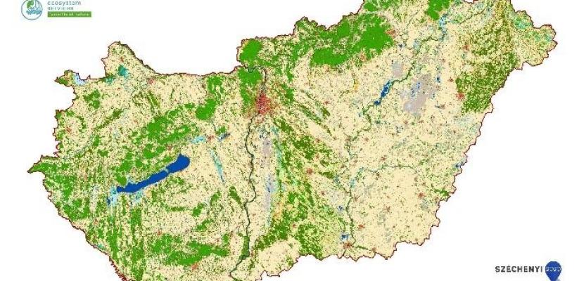
The first part of the project is mapping of ecosystems of Hungary as a basis for mapping ecosystem services: the MePAR (LPIS, Land Parcel Identification System) surface cover layer was used as a basis for the development of the Ecosystem Map of Hungary, which was complemented by additional databases with other thematic focus (e.g. Copernicus High Resolution Layers (HRL) for the reference year 2015 Water and Wetness (WAW) layer; National Forestry Database (OEA) data and a strong emphasis on the in-house processing of data collected by remote sensing methods to produce thematic categories (e.g. different grassland types). The resulting data were organised into a theoretical data cube with a uniform geometry (20 m raster) and projection (ETRS1989 LAEA), and from this data, targeted cell-based queries (Python based) were used to produce the final categories and thus the ecosystem map (in GeoTiff format).
The categories of the Ecosystem Map of Hungary are organised along a 3-level, structured hierarchical typology.
The second part of the project is identifying strategic frameworks for the conservation and development of green infrastructure. Its steps include: assessment of existing green infrastructure based on ecological condition, classification of areas for conservation, restoration and GI development, identification of environmental risk hotspots, identification of potential target status, classification of the feasibility of the intervention
Expert opinion
Resources needed
The project element named Mapping and Assessment of Ecosystem Services was implemented from around 39 million HUF, and the project element of green infrastructure around 19 million HUF.
Evidence of success
Between 11/2019 and 11/2023, the map was downloaded 1153 times (data based on monthly IP addresses filtered for uniqueness).
Based on the stated uses, the highest proportion of downloads were for nature conservation, education, agriculture, spatial planning and other research purposes.
The methodology and mapping results of the GI Assessment can be used in national, regional and municipal development and land use plans, and help implement the biodiversity strategy objectives.
Potential for learning or transfer
The methodology for mapping, assessing and delimiting restoration areas can be applied to other regions.
The good practice presented provides a tool to support reporting to strategic biodiversity commitments, with measurable targets and monitoring. It will support the achievement of the objectives of the EU's Biodiversity Strategy to 2030 (European Commission, 2020), the Green Deal (European Commission, 2019) and the Nature Restoration Law.
New is the consideration of the relationship between ecosystem services and ecosystems, and the assessment of potential vegetation conflict analysis as a means of identifying the proportion of ecosystem services and analysing rational indicators of feasibility (e.g. ownership, legal status).
