National Ecosystem and Ecosystem Service Mapping Pilot for a Suite of Prioritised Services

About this good practice
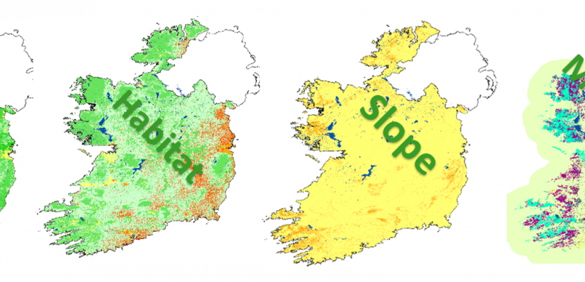
The NEES Mapping Pilot establishes a methodological framework for a National Ecosystem Assessment for Ireland. The pilot was designed to assist implementation of MAES under Target 2 Action 5 of the EU Biodiversity Strategy: ‘to Map and Assess in its national territory the state of Ecosystems and the Services they supply’. The mapping tool used for this project was SENCE (Spatial Evidence for Natural Capital Evaluation: https://ecosystemsknowledge.net/sence-spatial-evidence-natural-capital-evaluation), selected for its ability to be manipulated to accept a wide range of data sources at different scales, and its ability to deliver outputs for a variety of ecosystem services. It is a GIS system, which allows for stakeholder weighting to be applied and, therefore, local knowledge to be included. A key output is a Habitat Asset Register, a national scale habitat mapping tool containing 46 nationally relevant datasets. Datasets were identified and the tool developed through workshops with carefully selected stakeholders including organisations likely to be involved in implementing projects to restore ecosystems in Ireland; stakeholders with existing knowledge of environmental and societal issues and policy in Ireland, as well as; technical experts and other stakeholders with knowledge of relevant data and projects. The project team has engaged with local and regional authorities, particularly for developing city, county and regional green infrastructure strategies.
Expert opinion
The added value of this good practice lies in the involvement of a variety of relevant stakeholders with solid competences and knowledge, especially in the field of ecosystem restoration. Having people of this kind was crucial both for developing the methodological framework for assessing ecosystems at the national level and for engaging with local and regional authorities to advise them on how to reinforce the green infrastructure by means of projects and actions to better protect and restore ecosystem services. The fact that the developed methodology is starting to be used at the national level for measuring the value of ecosystem services for policymaking, economic or natural capital accounting purposes is also a great sign of its success. Local and regional authorities may certainly get valuable insights from this transferable good practice. They are also encouraged to develop and use instruments to map and assess ecosystems and their services on the ground with the support of EU investment and structural funds and EU direct funding instruments like Horizon Europe and the LIFE programme.
Resources needed
Funded by the Irish Government at a cost of €106,000 for an 11-month period. International leaders in the development of the Common International Classification of Ecosystem Services (CICES) and data management were contracted. Two NPWS staff worked on the project on a 50% basis for its duration.
Evidence of success
The NEES Pilot has been an important resource for regional and local authorities in Ireland as they begin to quantify and account for ecosystem services. At the regional level, the Eastern and Midland Regional Assembly has used the practice to demonstrate how ecosystem services can contribute to regional development for healthy living, climate action and economic opportunity. At the local level, municipalities have started to use the practice to quantify, map and value their ecosystem services.
Potential for learning or transfer
The need for an enhanced classification of CICES sub-classes depending on local characteristics was clearly identified by the practice. These sub-classes represent ecosystem goods and services that can be measured ‘on the ground’ and have policy or management relevance in a given regional context. Such identification provides the flexibility required to develop geographically specific applications. Being rule-based, the methodology is designed to be transparent and transferable. It uses scientific knowledge to score each ecosystem indicator using expert interpretation of the datasets used. The weightings are retained in a tabular format and the same approach can be applied to model and map other ecosystem services. The approach is iterative in nature and can be applied using standardised parameters. It can also be adapted using local knowledge and expertise. These factors make the practice highly transferrable between contexts and at multiple scales (local, regional or national).
Further information
Website
Good practice owner
You can contact the good practice owner below for more detailed information.
National Parks and Wildlife Service (NPWS) of the Department of Arts Heritage Regional, Rural and Gaeltacht Affairs, Ireland
