Land deformation monitoring with integrated geomatic technique in the Veneto Region

About this good practice
Because of its geological context, Veneto Region’s province of Rovigo, located in the south-east close to Po rivers’ mouth, is prone to slow natural subsidence.
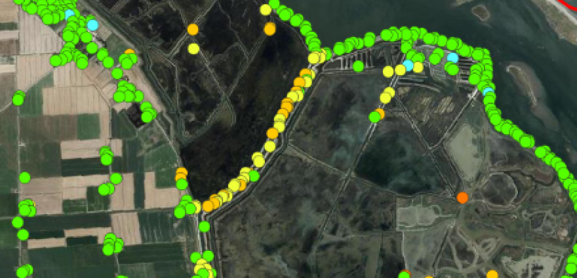
To monitor the phenomena, Veneto Region’s Directorate for Spatial Planning teamed up with academia (University of Padova and University of Florence) to develop an innovative technique integrating levelling lines, InSAR data and GNSS surveys.
The integrated use of these 3 different geomatic techniques result in a precise and updated ground deformations monitoring system, providing reliable and scientifically sound data to all territorial bodies and policy makers involved in soil protection and disaster risk management (specifically floods).
The possibility to visualise the results of these measurements in the regional Spatial Data Infrastructures has proven to be of high interest also for the general public and the local population, which can easily estimate if their land can be affected by subsidence or other types for land deformation.
Expert opinion
Resources needed
Financial resources for the levelling measurement: circa 100.000 €;
Human resources: contractualization of 1 full time GIS/ remote sensing expert.
Evidence of success
The practice is considered to be a success mainly for the scientific precision the measurement has achieved.
As an example, thanks to the technique it has been proven that in the Po River Delta area deformation values are: 1 ÷ 1.5 cm/year for the land subsidence; about 60% reduction in levee safety in 2100 (study by University of Padua, 2022 - Main authors: M. Fabris, A Menin).
Potential for learning or transfer
This practice can be of interest to any EU region whose land, or part of it, experiences land deformation phenomena, specifically subsidence.
For a successful implementation, collaboration with academic institutions is key. In fact, LRAs rarely have the internal know-how to analyse and process this kind of data. Therefore, to guarantee a solid scientific approach, it is advisable to set up partnership and/or agreements with academic or private institutions specialised in the geomatic sector.
Further information
Good practice owner
You can contact the good practice owner below for more detailed information.
